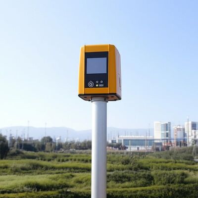
logo
ホーム 製品ドップラー風Lidar

Vertical Range minus 10 to 190 degrees remote data collection tool featuring 4 kilometer vertical measuring distance tailored for industrial

認証
中国 Nanjing Movelaser Co., Ltd. 認証
顧客の検討
製品品質は優秀で,私はそれを維持し続けることを望みます

—— リヨン・シヨン

あなたの会社の製品は 動作中に優れた性能と優れた品質を示しています初期プロジェクト風力測定や運用プロジェクト評価などのシナリオで強力なサポートを提供すること; あなたのチームは,設備の設置,保守に間に合う対応,効果的なコミュニケーション,そして配慮したサービスを提供します.

—— ユンダ・リ

プロダクトは問題を見つけた後、販売の後でをすぐに取扱うことができる。プロダクトをより多くの環境の。のために適したようにすることを推薦する

—— Jiemin Fu

全面的私は高度、より信頼できるおよび安定したレーダー装置を私達に与え続けて非常に満足し、希望である。

—— ファン ヤン

プロダクトが最大限に活用され、更新され、繰り返され続けること質より安定している期待され、サービス、配達およびアフターセールスは良質を維持し続けindustry-leadingレベルを達成する。

—— Yuwei Wang

プロダクトの配達は、装置の処理非常に時機を得ている

—— 長い陳

マーケティング スタッフの積極性、時機を得た売り上げ後のサービス

—— Kai肇

堅く、双方にとって好都合な協同を働かせ続けなさい

—— Yuyan Xie

装置およびサービスは非常によく、私は継続協同将来を楽しみにしている。

—— Mingjie Zhou

装置は取付け易く単位のテストのために適した。

—— ルークWang

地上の風lidarに良い業績があり、私達の内部および完全な機械製造業者によって確認され、試験結果への異議がない。販売スタッフに広範な専門知識および専門の答えがある。現地のスタッフは活発で、再度協力を楽しみにしている。

—— Kunpeng Lu

レーダーの設置サービスでは、マーケティング スタッフによい態度、lidarの交通機関そして取付けに固体保証を提供する強い技術的な能力があり、問題を解決する。

—— 梁高

この風力測定システムは、私たちのデータ収集を完全に変革しました。精度と安定性は抜群で、過酷な条件下でも優れています。技術サポートチームは非常にプロフェッショナルです!

—— ジェームズ・M.

LiDARデバイスを導入して以来、当社の風力発電所の評価効率は少なくとも40%向上しました。信頼性が高いだけでなく、使いやすさも兼ね備えています。この分野のすべての方に強くお勧めします!

—— ソフィア・チェン

卓越した精度 と 信じられないほど耐久性! フィールド ステーション は 長い間 この 機器 に 頼り て い まし た.最先端技術と実用的なデザインの完璧な組み合わせ.

—— アハメド・アル・ファルシ

研究者として,私は最も高いデータ精度を要求します.このシステムはすべての期待を上回っています.低電力消費と簡単な統合が,私たちのプロジェクトを大幅に加速しました.

—— エレナ・ロッシー

安定し,精密で,ほとんど保守が不要です. 必要な産業用ソリューションです. 運用コストを大幅に削減しながら エネルギー出力を最適化するのに役立ちます.

—— トーマス・ヘレラ

販売前コンサルティングから技術訓練まで サービス経験は完璧です 設備は優れた性能で 顧客の風力発電プロジェクトに重要な洞察を提供します

—— プリヤ・シャーマ

類似製品をいくつか試しましたが、このシステムは長期的な安定性とデータの整合性で際立っています。まさに、環境モニタリングにおける頼れるパートナーです。

—— ビョルン・ルンドグレン

オンラインです

Vertical Range minus 10 to 190 degrees remote data collection tool featuring 4 kilometer vertical measuring distance tailored for industrial

Vertical Range minus 10 to 190 degrees remote data collection tool featuring 4 kilometer vertical measuring distance tailored for industrial

大画像 :  Vertical Range minus 10 to 190 degrees remote data collection tool featuring 4 kilometer vertical measuring distance tailored for industrial

商品の詳細:
ブランド名: MOVELASER
Model Number: 3D Scanning Doppler Wind Lidar Molas 3D
お支払配送条件:
Minimum Order Quantity: 1 Set
Packaging Details: Air Box
Delivery Time: 1-2 Months
Payment Terms: L/C, D/A, D/P, T/T
Supply Ability: 200 Set ,1 Month
詳細製品概要
Size: 756mm*735mm*1000mm Sight Detection Distance: 10km
Maximum Acquisition Distance: 15km Distance Resolution: 15m/30m/75m/120m
Sight Wind Speed Accuracy: 0.1m/s Weight: ≤100kg
Pointing Acuracy: ±0.005° DataStorage Time: 5to18months
ハイライト:

Doppler Wind Lidar remote data collection

,

Doppler Wind Lidar 4km measuring distance

,

Doppler Wind Lidar industrial vertical range

Product Description:

Molas 3D is an advanced Doppler wind measurement lidar that operates using three-dimensional scanning technology. It utilizes the principle of pulsed laser coherent Doppler frequency shift to accurately capture wind speed data.

This innovative device supports multiple scanning modes, including P-Pl, RHI, DBS, and program scanning. Such versatility allows it to be tailored for specific wind speed measurement requirements across various applications.

The Molas 3D lidar is well-suited for a wide range of customized scenarios. These include offshore wind resource assessment, research in complex terrains, wind turbine wake detection, and airport glide path wind shear warnings. Additionally, it is valuable for urban meteorological observations and detecting high-altitude turbulence.


Features:

Comprehensive Measurement Capabilities

The system offers detailed measurement information by utilizing a refined 3D wind field measurement technique. It supports up to 300 customizable distance layers, allowing for precise and tailored data acquisition.

Wide Detection Range

Equipped with a large detection range, the device can monitor sight distances up to 10 kilometers, particularly effective at altitudes below 600 meters.

High Accuracy Performance

This technology ensures exceptional precision, featuring a pointing accuracy of 0.005 degrees and a visual direction wind speed accuracy of 0.1 meters per second.

Diverse Scanning Methods

Multiple scanning techniques are supported, including PPl, RHl, DBS, and a programmable arbitrary scan method, allowing for versatile operational modes based on varying measurement needs.

Flexible and Lightweight Deployment

Designed to be small and lightweight, the system facilitates easy transportation and rapid deployment in different environments.

All-Weather Durability

Built to withstand harsh outdoor environments, it offers survivability in LPz0 and features lightning protection zones, ensuring reliable operation regardless of weather conditions.

Safety and Security Features

Safety is paramount, with integrated GPS location reporting and geo-fencing capabilities. Additionally, data encryption safeguards against any risk of information leakage.

Multiple Configuration Options

Users can select from four distance resolutions and five accumulation times, providing flexibility to tailor the system’s operation to specific requirements.


Technical Parameters:

Vertical Range -10~190°
Sight Detection Distance 10 km
Sight Wind Speed Range -75~+75 m/s
Distance Resolution 15 m / 30 m / 75 m / 120 m
Sight Wind Speed Accuracy 0.1 m/s
Distance Layers Up to 300
Pointing Accuracy ±0.005°
Accumulation Time 0.2~10 s (Optional)
Data Storage Time 5 to 18 months
Vertical Measuring Distance 4 km

Applications:

Wind resource assessment involves collecting wind field data over extensive areas, which helps to minimize the risks associated with site selection for wind energy projects. By accurately measuring wind parameters, it ensures better planning and utilization of wind resources.

Long-distance power curve measurements and wake eddy current assessments play a significant role in optimizing wind energy utilization. These measurements contribute to improving the efficiency of wind energy units by providing detailed insights into wind flow dynamics and turbine performance.

Early detection and warning systems are essential for identifying dangerous meteorological phenomena, such as wind shear and microbursts. Timely warnings can enhance safety measures in aviation and other weather-sensitive operations.

Measuring wake vortices is crucial for optimizing flight separation at airports. By understanding these vortices, air traffic controllers can better manage aircraft spacing, thereby increasing airport traffic efficiency and safety.

Providing detailed wind field information aids in understanding the behavior of wind within the atmospheric boundary layer. This data is vital for meteorological studies and improving weather forecasting models.

Accurate and high spatiotemporal wind profile measurements near the surface, within a few kilometers, help fill the observation gaps at low altitudes. This enhanced data resolution supports various applications ranging from environmental monitoring to renewable energy development.

Real-time three-dimensional information about plume dispersion enables effective tracking of emission sources. Such monitoring is particularly valuable for environmental management and controlling air pollution.

Additionally, optimizing dust emission control in the mining industry relies on precise wind and dispersion measurements. These techniques help minimize environmental impacts and enhance operational safety in mining activities.


連絡先の詳細
Nanjing Movelaser Co., Ltd.

コンタクトパーソン: Miss. ivyyao

電話番号: +86 13072523225

ファックス: 86-025-86800073

私達に直接お問い合わせを送信 (0 / 3000)